![]() Research
Research
|
|
||||||
|
|
||||||
|
Research > Geographic Information Systems (GIS) |
|||
|
|
|
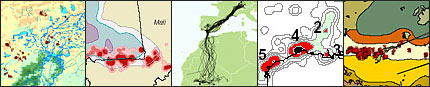
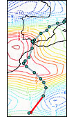
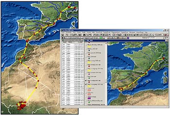
>> Geographic Information Systems (GIS) Geographic
Information Systems (GIS) are commonly applied when geographical
aspects of research on animal migrations, habitat selection, population
monitoring or results of similar projects are to be visualized.
GIS also is an important tool to analyse such results in connection
with climate data, vegetation data, topography, satellite images
etc..
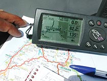
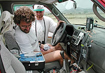
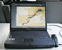
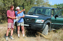
For our clients we have employed GIS applications (preferably the desktop applications ArcGIS and ArcView) in a number of ways: We used it for the analysis of data from terrestrial and satellite tracking and from ecological studies; we also applied it for visualizing the respective results in conference presentations, in publications and in the internet. And last not least we used GIS as a tool to facilitate the field work during expeditions, which were conducted to follow transmitter tagged animals during their migration. We
offer services regarding GIS application in the following fields
of research: -
Animal migrations and movements; |
|
|
|
|||
|
|
|||
|
|
|||